Hiking the Mt. San Jacinto Loop
“Statistically speaking we had nothing to worry about”
Logistics
In August 2020, two friends and I decided to hike the Mt. San Jacinto loop. The details of the loop included a distance of 18.5 miles and 5300 feet of elevation gain. We chose to do the clockwise version of the loop, as per recommendations from other users on AllTrails. The clockwise version had more tree cover on the ascent to the peak from the west, with the descent on the eastern side being more exposed.
Hiking out of Idyllwild
We arrived in the town of Idyllwild around 6:15 AM and got onto the trail by 6:30 AM. We had about eight and a half miles to the summit of Mt. San Jacinto so we wanted to get an early start to avoid any potential afternoon thunderstorms.
The trail meandered steadily upwards via switchbacks, always maintaining a steady incline. After warming our legs up over the first mile, we quickly got into a rhythm and our brisk uphill pace, we found, was not hard to maintain. As Oak and Mazanita trees gave way to all types of pines, we steadily gained elevation on our way to the junction that marked the start of the loop.
From the junction the trail remained largely the same, repeating the pattern of gradual switchbacks. After a while the trees became more and more sparse and we encountered seas of bushes. We pushed our way through the brush that, at times, was thorny and clawed at our legs. Higher up on the mountain, bushes gave way to more rocky terrain, dotted here and there with windswept trees. At eight miles in we were nearing the summit. That’s when my eyes moved skyward.
I had been intermittently watching the clouds above since the start of our hike. What started as the random wisp here and there eventually turned into herds of cumulous clouds. As we neared the summit, I could tell that the clouds were quickly coalescing into more ominous cumulonimbi. Out of fear of being on the summit during a potential lightning storm, I urged our group to hike a bit faster in a bid to get up and off the peak within the next half hour.
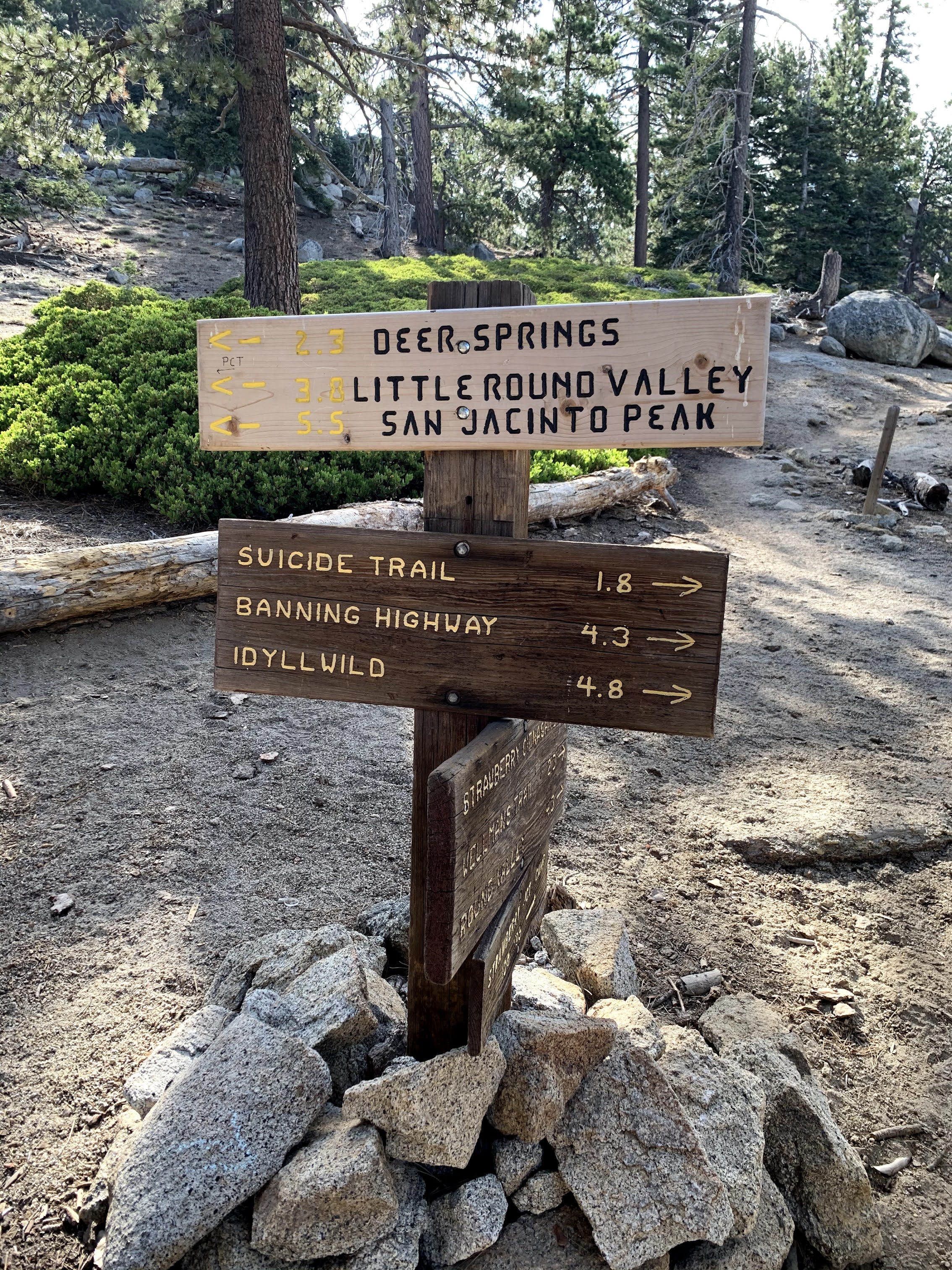
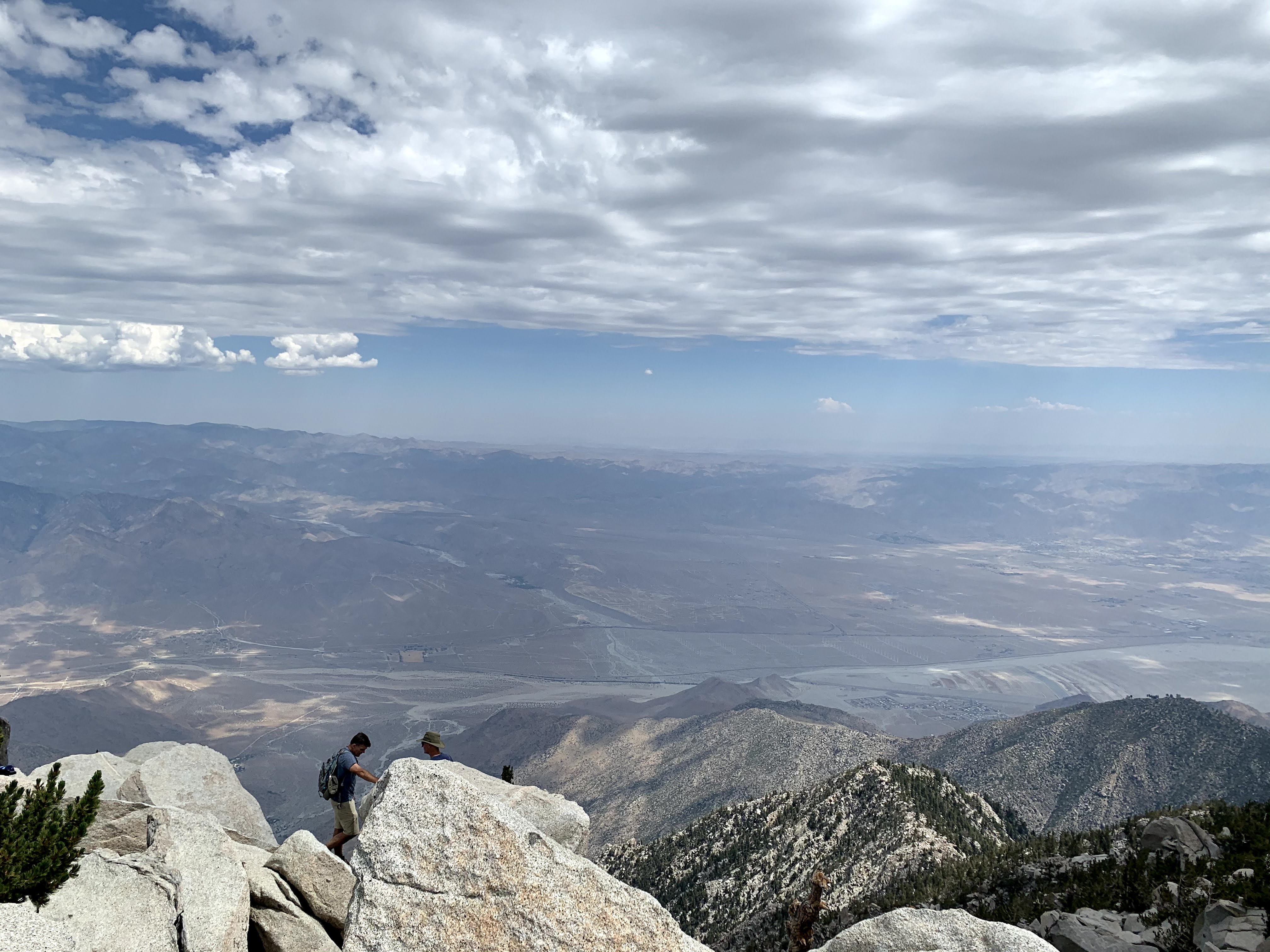
Once we reached the cabin near the peak all that was left was to scramble up some large boulders to the summit of Mt. San Jacinto. Below to our east we could see the sprawling flatness of Palm Springs, bathed in the summer heat. Legions of windmills stood silently still, solemnly watching over the nothingness of the desert. In the distance, the cumulonimbus clouds were yet to be threatening, however we did not want to take any chances. We took our obligatory photos at the peak, had some energy chews and water, and quickly began our decent down the other arm of the loop.
The decent from the peak started out hot, exposed, and chock-full of the same bushes we encountered earlier. Every few minutes, we’d nervously glance upward to monitor the clouds on the west side of the peak. No rumblings yet.
As we continued walking, the clouds began to form a long chain along the ridge line on the western face of Mt. San Jacinto. It was clear that we were not lucky enough to just leave the storm at the peak. Eventually, it seemed, our path with the storm system would inevitably cross once we crested the ridge to the loop junction. We only travelled a few more switchbacks before we heard our first thunderclap.
A slow rumbling filled the air, as if a beast had awoken from its slumber. We counted our blessings. We had yet to see any flashes or actual strikes. Statistically speaking we had nothing to worry about. We were low, well into the treeline, and were getting lower by the minute. Barring the unfortunate strike of a nearby tree, we were not in any immediate danger.
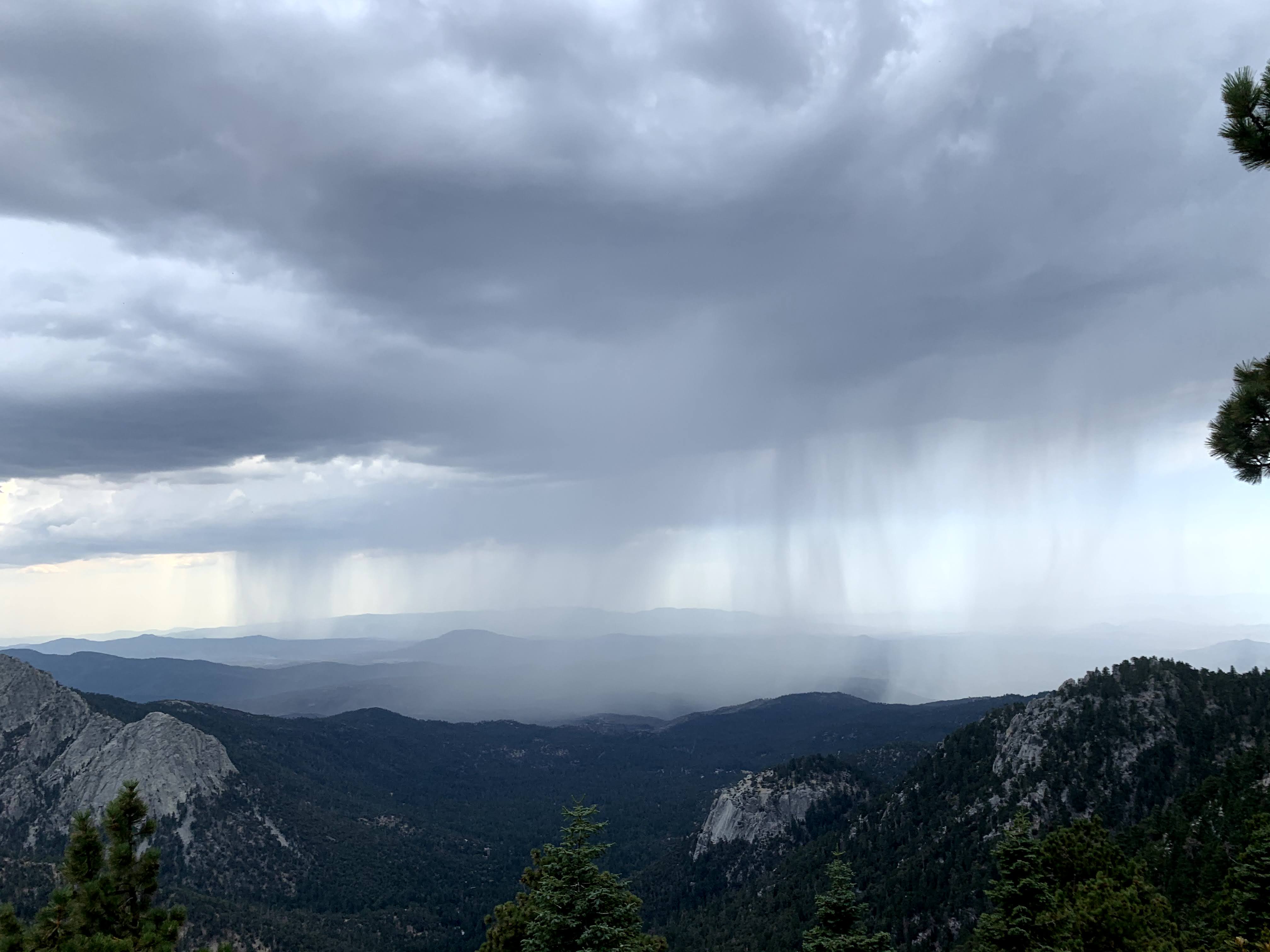
Once we got to the western side of Mt. San Jacinto, the situation became a bit more threatening. We found ourselves a bit higher and more exposed than to our liking. Panning out before us was a spectacular display of cloud-to-ground lightning strikes. Bolts from the clouds above were striking the valley near Idyllwild below us. Judging from the latency between the strike and the thunderclap, we estimated that the strikes were about six to eight miles away.
We continued to marvel at nature’s display of lightning unfold before us. Our pace was blisteringly, yet we our bodies did not feel it. We were so ensnared by the storm that we neglected shut out any and all feelings of weariness. As a result, we reached the loop junction rather quickly, and started the final descent back into Idyllwild. With over 13 miles completed and slightly over three miles left, we continued our furious descent.
At this point, we never saw any lightning flashes. Despite being directly underneath the part of the system where we had witnessed the lightning a few miles back. We only heard the occasional crackle of cloud-to-cloud lightning discharges. In hindsight, this was for the best. With only a few miles left, the sky opened above us and the rain began to fall. With the forecasted weather being sso hot, we never felt the need to put on our rain shells, as we would quickly soak ourselves from the inside out due to perspiration.
Instead we took to heart the physical and mental ups and downs of the day, grateful for our experiences, and grateful that we were nearing the end of our ambitious day hike. Soon enough, we were back at the car. Wet, dirty, tired, but finished. 18.5 miles completed with plenty of stories to recount to our friends and families in the hours and days ahead. Until next time Mt. San Jacinto.